Dominican Republic
The Dominican Republic occupies the eastern two-thirds of Hispaniola and is the second-largest country in the Caribbean by area and population, with 11.4 million residents (2025). It borders Haiti to the west and is surrounded by the Atlantic Ocean and the Caribbean Sea. Its location and terrain make it prone to hurricanes, flooding, and seismic activity.
Digital connectivity has expanded steadily, with over 10.4 million mobile connections and 84 percent internet penetration. Emergency telecommunications are supported by Claro Dominicana and Altice, though coverage gaps remain in remote and mountainous areas.
Disaster response is led by the Centre for Emergency Operations (COE), which coordinates with national agencies and international partners to ensure communication and rapid mobilization.
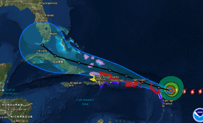
In late October 2025, Hurricane Melissa brought torrential rains, flooding, and landslides, especially in southern provinces. COE reported over 900 displaced residents, 183 damaged homes, and 19 isolated communities. Electricity remained stable, supporting recovery efforts as shelters and humanitarian agencies mobilized.
The ETC has not been formally activated but remains engaged through regional preparedness with the Caribbean Disaster Emergency Management Agency (CDEMA) and national stakeholders. It stands ready to support response efforts if needed.
ICT Profile
Office of Disaster Management
Ministry of Public Works and Communications
Dominican Telecommunications Institute
10,847,904
Source: World Bank 2020
The Dominican Republic (DR) is classified as a small island developing state (SIDS) and is located in the Caribbean. It has a land area of approximately 48,600 km2, occupying the eastern two thirds of the island of Hispaniola; Haiti occupies the remaining western one third. Apart from the western border with Haiti, the rest of the country’s 1,126 km of coastline lies on the Atlantic Ocean and Caribbean Sea. The DR is generally mountainous, with deserts in the extreme western regions. The principal mountain range, the Central Cordillera, runs from east to west, is covered primarily by pine forests, and bisects the country. Between the Central Cordillera and the Northern Cordillera mountain ranges lies the Cibao (La Vega Real) Valley, approximately 225 km long and known for its excellent soil quality. Fertile valleys also abound in the central and eastern areas. The country hosts both the highest mountain in the West Indies, Mt. Duarte and the lowest-lying lake, Lake Enriquillo, a saltwater lake that sits at 46 meters below sea level; the third lowest point in the Caribbean. The Yaque del Norte, the Yaque del Sur, and the Yuna are country’s the principal rivers.
Dominican peso
59.6
Source: GSMA Intelligence 2019
99
The purpose of this law is to outline the overall framework of disaster risk management in the Dominican Republic. It also sets a number of other laws regulate directly-related sectors, including the management of the environment and natural resources, building and construction, education, health and water management.
The purpose of this law is to regulate the installation, maintenance and operation of networks, the rendering of services and the provision of telecommunication equipment.
The Dominican Republic is not a signatory to the Tampere Convention.
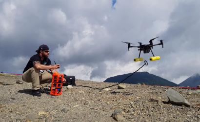
There are active drone regulation laws in the Dominican Republic.

