Nepal
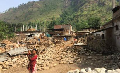
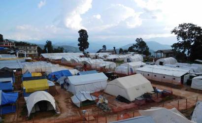
The ETC was activated in 2015 following the 7.9 magnitude earthquake which struck the centre of the country.
Even before, and especially following, the quake Nepal had a well-established ICT Working Group, bringing together humanitarians, private sector and governmental bodies to coordinate emergency preparedness and response for the country. As global lead of the ETC, the World Food Programme (WFP) coordinates the ICT Working Group in Nepal.
Given this cooperative environment, an ETC2020 Pilot Project was conducted Nepal, focusing on Communications with Communities (CwC).
To participate in the ICT Working Group in Nepal, contact: Global.ETC@wfp.org
ICT Profile
Nepal Centre for Disaster Management
Ministry of Communications and Information Technology
Nepal Telecommunications Authority
29,136,808
Source: World Bank 2020
Nepal is a landlocked country of South Asia, located in the Himalayas between India and China. The terrain is generally mountainous and contains many of the world’s highest peaks, including Mount Everest (8,848 meters [m]). The country also has low-lying areas in the south with elevations less than 100 m. About 80% of the country’s 28 million inhabitants (2019) live in rural areas.Nepal’s climate varies considerably both seasonally and according to altitude. Nepal can be divided into different climate zones according to altitude, ranging from the Terai region in the south at less than 500 m above sea level to the High Himalayan region in the north at over 5,000 m. Average temperatures decline from a peak of over 24°C in the south down to sub-zero temperatures in Nepal’s highest mountains. Precipitation is spatially variable with some central and northerly pockets of the country receiving more than 3,000 millimeters (mm), the central and southern plains typically receiving 1,500 – 2,000 mm, and some high-altitude areas in the north receiving less than 1,000 mm.
Nepalese rupee
47.8
Source: GSMA Intelligence 2019
60
Source: GSMA Intelligence 2019
The purpose of this law is to unify the law on reduction of disaster risks and management, and to keep physical infrastructures safe from natural and non-natural disasters by effectively coordinating and managing all activities on reduction of disaster risk and management.
The purpose of this law is to make the Telecommunications service reliable and easily available to the public, involve private sector as well in Telecommunications Service and to regularise and systematize such service.
Tampere Convention
There are active drone regulation laws in Nepal.